2 hours. Plus, optionally, 1 to 2 hours for a follow up “walking tour” session
Where can it be used
It can be used indoors in a community space or classroom. Equally it can be adapted to use online using digital mapping. At a later stage it can be used outdoors in touring or visiting the neighbourhood.
Group size
An optimum group of 4 to 8 participants
Objective
Participatory mapping is a map-making process that attempts to make visible the association between land and local communities. It facilitates reflection on what characterizes a neighbourhood and what are the social changes that communities can undertake to regenerate it
When to use it
It is useful at the outset of a Collective Action Project in understanding context and in establishing goals and objectives for neighbourhood change
Step-by-step guide
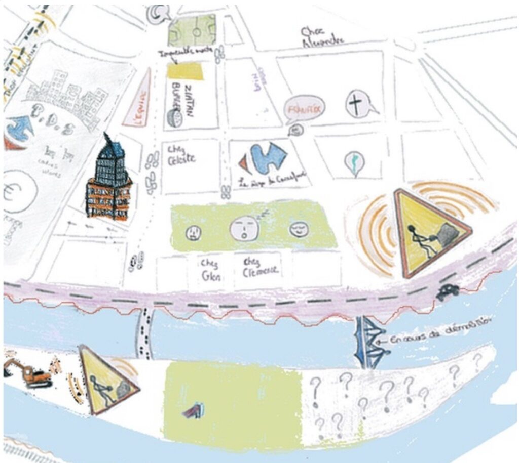
1. Ask the participants to draw a map of their neighbourhood, to locate on their map three places that are meaningful to them and to draw these places. Alternatively they can add stickers or placemarkers to an existing map.
2. Ask them then to add to their map and draw three places that they do not visit, or try to avoid
3. Each participant presents their map, taking the group on an imaginary “tour” through the neighbourhood to the places.
4. Facilitate a discussion between participants comparing their maps and questioning why they made the choices.
5. Ask the group to identify three changes arising from the discussion which would improve their neighbourhood.
6. At a later stage, if feasible, participants may lead a walking tour of the neighbourhood for the group to experience the places for themselves. What does this experience add to the perceptions already expressed?
Materials needed
Large sheets of paper. Coloured pens/pencils.
Or use existing maps and provide placeholders/stickers as well.
If the group is online, Google maps can be used as a starting point.
Tips for facilitators
The discussion is intended to generate ideas for change by highlighting what is valued in a specific neighbourhood and understanding why. Comparing different views about a place can lead to deeper understanding of the perspectives and values of different groups. The process may raise awareness of challenges, exclusions or barriers that may be faced. The discussion may also surface information and data that otherwise may be hidden, including perceptions, emotions and experiences. The maps may also highlight the connections between places and the routes people take through the public space and why. In stage 5, which identifies common themes to inform ideas for change the facilitator should take special note of the differences in perception of place and how these can be accommodated in the ideas for change, what may be gained and what may be lost?
Possible variations
It can be adapted to use existing maps, providing placeholders or stickers to indicate locations. However it is important that participants make drawings of the places they choose in order to imaginatively visualize what they value (and don’t value).
It can be also adapted online using Google maps for the locations and online drawing tools for the visualizations.